
- Home
- History
- Community
- Organizations
- Chinese Consolidated Benevolent Association
- Victoria Chinese Canadian Veterans Association
- Chinese Public School
- Clan Associations
- County Assocations
- Dialect Assocations
- Friendship Associations
- Political Organizations
- Recreational Associations
- Religious Organizations
- Women's Associations
- Other Organizations
- People
- Resources
- Contact
Victoria Bird's-Eye Map - 1889
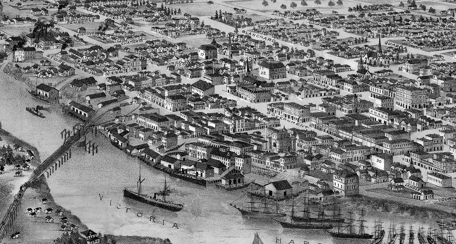
This 1889 Bird’s Eye Map of Victoria shows the new building of the Chinese Consolidated Benevolent Association (1885), the tallest structure near the corner of Government and Fisgard Streets. Facing the viewer on Cormorant Street (now Pandora Avenue) west of Government Street are a series of store fronts from the older centre of Chinatown that have since been replaced or demolished.
This map was created by Ellis & Co. and is used with permission from Dr. Patrick Dunae and viHistory.ca, a website containing census data, directories, property tax assessments and maps relating to Vancouver Island’s history.